A naukri.com initiative
Dronelife
2w
398
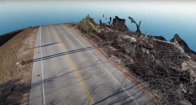
Image Credit: Dronelife
Drone Mapping Transforms Police Crash Investigations: A Blue Marble Geographics Case Study
- Drones are increasingly vital for law enforcement, aiding in real-time awareness, first responder programs, and crash investigations.
- A case study by Blue Marble Geographics showcases how drone mapping is revolutionizing crash investigations for the Windham, Maine Police Department.
- The process involves aerial data capture, ground control points, photogrammetric processing with Global Mapper Pro®, and detailed analysis and measurement.
- Using drones saves time, enhances officer safety, speeds up investigations, and provides court-ready documentation, benefitting both law enforcement and communities.
Read Full Article
23 Likes
For uninterrupted reading, download the app