A naukri.com initiative
Dronelife
3w
412
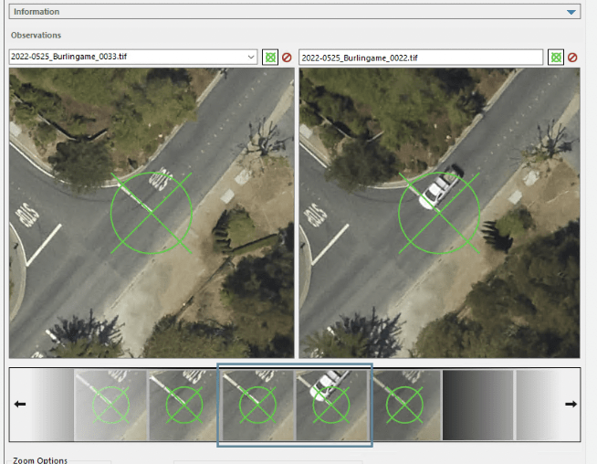
Image Credit: Dronelife
Enhancing Drone Mapping with RTK and PPK: Insights from SimActive’s Eric Andelin
- RTK and PPK technology are transforming drone mapping, enhancing accuracy and efficiency by reducing reliance on Ground Control Points (GCPs). SimActive's Correlator3D software offers powerful tools for processing drone imagery, satellites, and manned aircraft data.
- Eric Andelin from SimActive highlights the differences between RTK and PPK in implementation and accuracy. RTK involves a base station and rover setup, while PPK leverages external networks like CORS for precise positioning.
- RTK and PPK offer high accuracy, with PPK providing flexibility in terms of connection. However, validation through targeted control is crucial for ensuring reliability in mapping data.
- Compared to traditional GCP methods, RTK/PPK can offer cost and time savings, with PPK eliminating the need for additional survey equipment, despite higher initial drone costs.
- Challenges include RTK's need for constant drone connection and PPK's reliance on ephemeris data, with environmental factors like dense vegetation affecting technology effectiveness.
- RTK and PPK adoption has influenced drone mapping practices, emphasizing the importance of targeted control for verifying accuracy and avoiding over-reliance on these technologies alone.
- While RTK and PPK reduce GCP network needs, targeted control remains crucial for validation. Andelin stresses the ongoing importance of GCPs for high-precision mapping applications.
- Drone pilots transitioning to RTK/PPK should follow ASPRS guidelines, set a network of targets, and validate results against targeted control for accurate mapping outcomes.
- Regulatory considerations are important, with varying state regulations on surveying and photogrammetry requiring drone operators to ensure compliance before commercial mapping.
- RTK and PPK, alongside tools like SimActive's Correlator3D, offer significant benefits for mapping accuracy. Understanding and implementing these technologies correctly are crucial for producing reliable maps.
- As drone technology advances, the industry must prioritize validation through targeted control, ensuring the quality and precision of drone-based photogrammetry outputs.
Read Full Article
24 Likes
For uninterrupted reading, download the app