A naukri.com initiative
Unite
1M
40
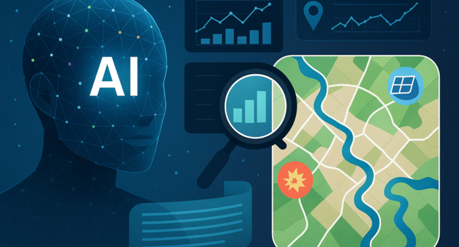
Image Credit: Unite
How Google’s Geospatial Reasoning Can Transform Crisis and Climate Response
- Google's geospatial artificial intelligence advancements, including its Geospatial Reasoning framework, enhance interactions with spatial data for professionals in various fields.
- The framework combines generative AI and specialized geospatial models utilizing Gemini, Google's advanced large language model, to answer complex geospatial questions in real time.
- Google's remote sensing foundation models, combining satellite and aerial imagery analysis, are crucial in addressing complex geospatial queries for crisis response and climate resilience.
- In crisis response, Google's geospatial reasoning aids responders in quick decision-making by providing real-time insights during disasters like floods, wildfires, or earthquakes.
- For long-term climate resilience, Google's AI framework analyzes satellite imagery to predict future climate risks and environmental changes, assisting in adaptation and mitigation strategies.
- Google's geospatial AI technology offers scalability and accessibility by enabling users to interact with data through natural language queries, benefiting professionals in urban planning, emergency response, and environmental science.
- The framework's ability to interpret complex data ensures informed decision-making, emphasizing the importance of transparency, accountability, and ethical considerations in using geospatial AI.
- Human oversight is essential to verify and interpret AI-generated insights correctly, especially in critical scenarios like disaster response and climate planning.
- Google's geospatial AI has the potential to revolutionize crisis response and climate resilience efforts, but responsible deployment and ethical usage are critical for equitable benefits and sustainable development.
- Continued development and careful oversight of geospatial reasoning technology can contribute significantly to building a more resilient and sustainable future for all communities.
Read Full Article
2 Likes
For uninterrupted reading, download the app