Dronelife
2w
4

Image Credit: Dronelife
Mastering Drone Mapping: Expert Tips for Success from SimActive’s Eric Andelin
- Eric Andelin, Senior Workflow Specialist at SimActive, provides tips to drone operators for high-quality results including overcoming challenges, optimizing workflows, and setting up drone mapping projects for success.
- SimActive offers Correlator3D™, a robust mapping software designed to convert drone data into accurate geospatial products with tools for aerial triangulation (AT), creating dense digital surface models (DSMs), digital terrain models (DTMs), orthomosaics, and even vectorized 3D features.
- According to Andelin, Correlator3D™ offers a simple-to-follow interface that doesn’t require extensive retraining when expanding to other imaging platforms.
- SimActive maximizes processing speed by relying on GPUs instead of CPUs, enabling faster and more efficient workflows.
- Many drone operators struggle with processing complexities and SimActive helps operators overcome these challenges by allowing fine-tuning of workflows to produce outputs tailored to specific project requirements.
- Andelin emphasized three key strategies for success: plan your flights carefully, Incorporate ground control, focus on actionable deliverables.
- Flight planning is critical to mapping accuracy. Operators should evaluate the terrain and subject before setting their flight parameters.
- Wind and sun angle are two major factors to consider, said Andelin. While shadows might be useful in certain projects, they can complicate others.
- SimActive designed Correlator3D™ to handle unlimited images. Projects can benefit from distributed processing, which allows operators to leverage multiple PCs and GPUs to manage extensive datasets efficiently.
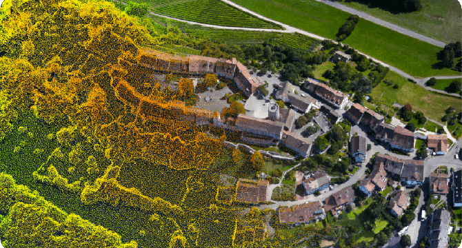
- LiDAR enhances mapping where photogrammetry cannot see the ground, while also enabling image alignment and ground control. The software even supports colorizing LiDAR point clouds, making them more versatile as standalone deliverables.
Read Full Article
Like
For uninterrupted reading, download the app