A naukri.com initiative
The Verge
4w
239
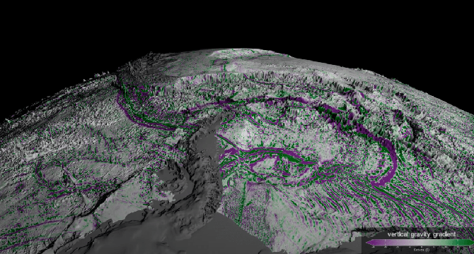
Image Credit: The Verge
Watch this ultra-detailed animation of the seafloor
- NASA has published a video showcasing a highly detailed seafloor map created using observations from the Surface Water and Ocean Topography (SWOT) satellite.
- The SWOT satellite provides a clearer look at the seafloor, filling in gaps in data collected by ships and offering higher resolution images.
- These detailed seafloor maps can help submarines navigate more safely and assist in laying down and repairing underwater telecommunication cables.
- The video published by NASA highlights the remarkable advancements in seafloor mapping and the potential applications of the technology.
Read Full Article
14 Likes
For uninterrupted reading, download the app