A naukri.com initiative
Nasa
4w
254
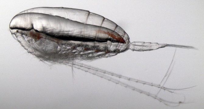
Image Credit: Nasa
NASA Data Helps Map Tiny Plankton That Feed Giant Right Whales
- NASA satellite data is being used to track tiny zooplankton called Calanus finmarchicus, which are crucial for North Atlantic right whales' survival.
- By detecting swarms of Calanus at the ocean surface in the Gulf of Maine, researchers hope to better estimate feeding grounds for whales and reduce threats like vessel strikes and fishing gear entanglements.
- This approach utilizes data from NASA's Aqua satellite's Moderate Resolution Imaging Spectroradiometer to detect subtle changes in ocean color caused by zooplankton pigments.
- The study, funded in part by NASA's Early Career Research Program, aims to connect space-based observations with real-world challenges for science and ecosystem conservation.
- The satellite-based method for tracking zooplankton could help identify unknown whale feeding grounds and facilitate more efficient operation of shipping and fishing industries.
- With the launch of the PACE satellite, improvements in detecting zooplankton are expected, providing finer detail and better insights into ocean ecosystems.
- Despite current limitations in the method, such as potential misidentification of small organisms and weather interference, the PACE satellite is anticipated to enhance zooplankton detection capabilities.
- Understanding North Atlantic right whales' elusive behavior and feeding patterns is crucial for their conservation, especially in light of increased mortalities due to vessel strikes and fishing gear entanglements.
- Scientists are optimistic that combining satellite data with local knowledge of plankton patterns will offer valuable insights to aid decision-making and protect whale populations.
- The use of satellite technology in tracking zooplankton highlights the intersection of space science with marine conservation efforts, showcasing the potential for innovative solutions to ecological challenges.
Read Full Article
15 Likes
For uninterrupted reading, download the app