Nasa
3w
184

Image Credit: Nasa
NASA’s C-20A Studies Extreme Weather Events
- NASA's C-20A aircraft can carry key instruments providing data to assess and model disaster impacts and potentially make predictions about hazards.
- The C-20A is a military version of the Gulfstream III business jet and operates as an airborne science aircraft for a variety of Earth science research missions.
- The plane was deployed in the aftermath of Hurricane Milton to collect detailed data about the affected flood areas using the Uninhabited Aerial Vehicle Synthetic Aperture Radar (UAVSAR) instrument to help inform disaster response and preparation in the future.
- UAVSAR uses a technique called interferometry to detect subtle changes to Earth’s surface and can measure terrain changes or impacts before and after a natural disaster.
- UAVSAR can also provide more detail than satellite radars and calibrate ground-based instruments. We can design overlapping flights in three or more directions to detect more textures and motions on the Earth’s surface, a big advantage over single flights.
- The C-20A team also used the UAVSAR to investigate the Portuguese Bend landslide in Rancho Pales Verdes, which has been moving at increasing rates during dry seasons.
- Airborne data can inform how scientists and experts understand extreme phenomena on the ground.
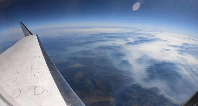
- NASA's C-20A was also used to provide crucial insight for studies of wildfire, as the Fire and Smoke Model Evaluation Experiment (FASMEE) deployed flights of the C-20A to study fire behavior and smoke.
- Researchers on the FASMEE experiment will use the collected data to better understand fire behavior and smoke production and help mitigate fire risk, restore degraded ecosystems, and protect human communities from catastrophic fire.
- Jacquelyn Shuman, FireSense project scientist at NASA's Ames Research Center in California's Silicon Valley said, “We can explore how fire managers can use airborne data to help make decisions about fires.”
Read Full Article
11 Likes
For uninterrupted reading, download the app