A naukri.com initiative
Nasa
2d
154
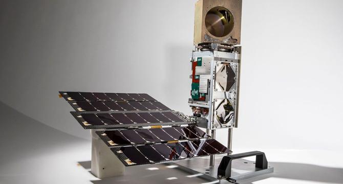
Image Credit: Nasa
NASA’s TROPICS Mission: Offering Detailed Images and Analysis of Tropical Cyclones
- NASA's TROPICS mission focuses on providing detailed images and analysis of tropical cyclones to aid in forecasting and understanding storm dynamics.
- Existing Earth observing platforms have aided tropical cyclone research for over 30 years, but there is a need for more frequent observations in tropical regions.
- The TROPICS mission aims to obtain 3D temperature, humidity, and precipitation measurements with a one-hour revisit rate using a constellation of small satellites.
- TROPICS imagery provides insights into storm structures, temperature soundings, and moisture soundings with high spatial resolution.
- The mission has successfully operated for two years, offering geophysical products that enhance understanding of tropical cyclones.
- TROPICS data enables rapid quantitative observations, evaluating warm core development and ice water path within storms for improved forecasting.
- Collaborations with operational weather forecasters have proven beneficial in utilizing TROPICS data for research, forecasting, and decision-making.
- TROPICS observations have been used to track hurricanes, characterize storm structures, and validate measurements using NOAA aircraft data.
- The mission has produced a significant data record spanning 10 billion observations and has made data products available to the public for research and forecasting purposes.
- TROPICS data contributes to enhancing numerical weather prediction models and operational forecasts, ultimately aiding in global tropical cyclone characterization.
Read Full Article
9 Likes
For uninterrupted reading, download the app