Drones News
Insider
332

Image Credit: Insider
NATO ships are at rising risk. Top commanders tell BI it's time to rethink naval defense.
- NATO warships face increasing threats, as commanders urge for improved naval defenses amid rising risks from conflicts like in Ukraine and the Red Sea.
- The conflicts have revealed vulnerabilities and emphasized the need for layered defenses, cost-effective countermeasures, and enhanced ammunition stockpiles for NATO naval forces.
- Threats include hostile drones, missiles, and naval vessels using advanced combat technology, prompting the alliance to adapt to a more dangerous naval warfare landscape.
- Instances such as Ukrainian drones damaging Russian warships and Houthi attacks in the Red Sea highlight the evolving risks faced by NATO warships.
- NATO is learning crucial lessons from these conflicts regarding the need for readiness to deal with higher intensity threats and the importance of defensive capabilities.
- The significant risk posed by global actors employing military force emphasizes the necessity for robust naval defenses and investments in missile stockpiles.
- Efforts are underway to address the challenge posed by inexpensive strike drones by developing cost-effective defense strategies to counter these threats.
- Lessons from recent conflicts are being integrated into NATO combat training, with exercises like Formidable Shield focusing on defending against various threats, including drones and uncrewed surface vehicles.
- Despite evolving threats, traditional large platforms like aircraft carriers remain relevant due to their global force projection capabilities and protective strike groups.
- NATO is adapting to the changing dynamics of naval warfare, prioritizing preparedness, defense innovations, and training to navigate the complex challenges faced by modern naval forces.
Read Full Article
20 Likes
Tech Radar
13
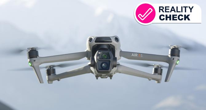
Image Credit: Tech Radar
Will DJI drones be banned in the US? DJI says the clock is ticking –and it urgently needs its fans to help
- An act passed by Congress requires security review of DJI drones by December 2025 to avoid a ban.
- DJI has not yet started the review process with relevant agencies, despite more than six months passing.
- The FY25 NDAA mandates assessment of Chinese-manufactured drones such as DJI for national security risks.
- If no agency completes the audit, DJI drones could be restricted in the US market.
- DJI has urged users to support in avoiding the ban and cooperates with rulemaking processes.
- For now, DJI drones remain legal in the US, but the countdown for a potential ban is on.
- Existing owners may face disruptions in support and future updates if the ban is enforced.
- DJI and its customers would be significantly impacted by a potential ban on new drone models.
- The threat of a ban relies on bureaucratic action, and users might need to advocate for continued access to DJI drones.
- DJI is encouraging users to engage in advocacy efforts to prevent the US ban on its drones.
Read Full Article
Like
Dataprivacyandsecurityinsider
26

Trump’s Drone Duet: Executive Orders Cracking Down on Threats While Boosting U.S. Drone Leadership
- On June 6, 2025, President Donald Trump signed two executive orders to reshape U.S. drone policy.
- One order focuses on protecting national airspace from malicious drone threats.
- The other order aims to boost the U.S. drone industry at home and abroad.
- The first order includes creating a task force, new FAA rules, and better geofencing tools.
- It also mandates law enforcement actions against reckless drone use and enhanced drone detection.
- The second order promotes U.S. drone innovation and exports by easing regulations and expanding test sites.
- It introduces rules for beyond visual line of sight flights, AI-powered waiver reviews, and supply chain protections.
- The orders aim to bolster U.S. drone dominance and protect airspace while fostering innovation and exports.
- They set the stage for a comprehensive strategy to enhance the drone industry in the U.S.
- The future of drones in America is poised for growth and technological advancement.
Read Full Article
1 Like
Firstquadcopter
153

Image Credit: Firstquadcopter
BetaFPV Meteor75 Pro O4: 4K Whoop in your pocket
- The BetaFPV Meteor75 Pro O4 is a compact Whoop-style FPV drone designed for indoor and outdoor flying with improved hardware and O4 Air Unit support.
- Powered by a 1S battery, the Meteor75 Pro O4 offers lightweight performance and 4K video clarity, ideal for confined space flights.
- The drone comes with an elegant unboxing experience, featuring components like motors, propellers, canopy, and shock-absorbing parts.
- It has a lightweight polypropylene frame, 1102 22000KV motors, and a soft-mounted flight controller for stability and durability.
- Installation of the DJI O4 Air Unit into the Meteor75 Pro is explained through a detailed build instruction video provided by BetaFPV.
- The initial setup, ELRS radio binding, and FPV goggles pairing are straightforward, enabling quick and hassle-free flight preparation.
- The Meteor75 Pro O4 is optimized for smooth high-definition footage with advanced flight control and precise tuning, suitable for FPV filmmakers.
- Flight performance of the Meteor75 Pro O4 is fun for proximity park flying and indoor practice, but not intended for long-range flights.
- The drone offers a flight time of around 4-5 minutes with a LiHV battery, and the frame is sturdy with minimal damage upon crashes.
- Fixing jello effect in the video feed and recorded footage involves ensuring proper installation and adjusting components as recommended by BetaFPV.
Read Full Article
9 Likes
Dronelife
250

Image Credit: Dronelife
DJI Announces FlightHub 2 On-Premises and Updated Security White Paper Amid Ongoing U.S. Security Debate
- DJI announces FlightHub 2 On-Premises and updates its security white paper focusing on data privacy amid U.S. security concerns and supply chain dependency.
- The company emphasizes data security efforts with the release of FlightHub 2 On-Premises and the 2025 Drone Security White Paper, addressing user privacy and data protection.
- FlightHub 2 On-Premises offers local data management for industries like energy, transportation, and government, ensuring data remains within internal networks to minimize unauthorized access.
- DJI's 2025 Drone Security White Paper includes updates on data protection features, privacy controls, and compliance with industry standards, encouraging transparency and informed decision-making.
- Amid ongoing security debates, U.S. lawmakers discuss the security of Chinese drones like DJI, with calls for diversification to reduce over-reliance on a single company or supply chain.
- Proponents of a ban on Chinese drone platforms cite national security risks, while DJI maintains its commitment to user privacy, transparency, and security improvements.
- DJI plans to strengthen security systems, engage independent experts, and enhance user accessibility to security practices, aiming to address concerns and improve transparency.
- Users are encouraged to visit the DJI Trust Center for more information and follow DJI's updates on security practices amid regulatory scrutiny and industry discussions on national security and supply chain resilience.
- The latest updates by DJI coincide with the broader dialogue on foreign drone platforms' role in U.S. national security and the future development of the drone industry.
Read Full Article
15 Likes
Dronelife
0
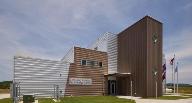
Image Credit: Dronelife
Choctaw Nation Launches Cutting-Edge Aviation Technology Center in Southeastern Oklahoma
- The Choctaw Nation of Oklahoma launched its Emerging Aviation Technology Center in Daisy, Oklahoma, to support drone innovation and job creation.
- The facility, spanning over 44,000 acres, provides a venue for developing advanced aerial systems in a low-risk environment.
- The center includes various amenities like office space, telemetry rooms, and drone maintenance areas.
- Chief Gary Batton highlighted the importance of this center for advancing aviation technology for the benefit of communities.
- The Choctaw Nation has a history of leading aviation initiatives, making this technology center significant for uncrewed aviation.
- James Grimsley emphasized the potential of drone medical deliveries in enhancing healthcare access and emergency response in rural areas.
- The center aims to boost the local economy, create jobs, and attract industry partnerships in southeastern Oklahoma.
- The Choctaw Nation's investment in aviation technology aligns with its commitment to technology, infrastructure, and community development.
- To learn more about the center and Choctaw Nation's initiatives, visit https://cnoaa.com.
- The Choctaw Nation is the third-largest Indian Nation in the U.S., with a significant presence in southeastern Oklahoma.
- Miriam McNabb, Editor-in-Chief of DRONELIFE, covers the emerging drone industry and regulatory landscape.
- null
- The Choctaw Nation's initiative signifies a step towards advancing technology, fostering job creation, and bolstering regional growth.
- The technology center is poised to drive innovation and serve as a hub for aviation research in the region.
- The Choctaw Nation's commitment to technology and community well-being is reflected in its investment in the aviation sector.
- The article covers the significance of the Choctaw Nation's technology center in promoting drone innovation, job creation, and regional economic development.
Read Full Article
Like
Dronevideos
237

Image Credit: Dronevideos
John Deere Purchases Drone Technology Company
- John Deere's history traces back to a blacksmith named John Deere who revolutionized farming tools in the 1830s, leading to the iconic American agricultural brand we know today.
- The brand's success lies in its constant innovation, from steel plows to mechanized farming to modern precision agriculture.
- John Deere remains at the forefront of agri technology, recently acquiring Sentera, a company specializing in advanced drone-mounted imaging sensors and software.
- Sentera's FieldAgent software processes drone-collected data into actionable insights for farmers and agronomists, aiding in real-time decision-making.
- Drones have evolved in agriculture from primarily applying chemicals efficiently to collecting extensive data crucial for informed farming decisions.
- Collaborations between John Deere and Sentera have been ongoing, enhancing autonomous technology within agriculture.
- John Deere's acquisition of Sentera aims to integrate high-resolution drone imagery with weed-mapping solutions for more targeted spraying and enhanced weed management.
- The collaboration between the two companies enhances operational efficiency, logistics, and ultimately economic outcomes for farmers and agronomists.
- The advanced drone technology and data analytics integrated by John Deere from Sentera reflect the company's ongoing commitment to agricultural innovation.
- John Deere's journey from crafting steel plows to incorporating drone technology underscores its dedication to helping farmers work smarter and promoting sustainable agriculture.
Read Full Article
14 Likes
Dronelife
136

Image Credit: Dronelife
Low-SWaP Radars Bring Mobile Drone Detection to the Tactical Edge
- New Low-SWaP radar technology is enabling rapid and high-performance drone detection for security teams on the move.
- Drones evolving in speed and size have necessitated flexible and mobile detection systems.
- Traditional drone detection systems are being replaced by portable and energy-efficient radars.
- Low-SWaP radars are compact, lightweight, and operate on minimal power, ideal for dynamic deployments.
- AirSight's AirGuard platform integrates Echodyne's radar panels for swift and flexible drone detection.
- Low-SWaP radars can be swiftly deployed in various scenarios and run on portable power sources.
- Benefits of Low-SWaP radars include quick setup, efficient power use, adjustable coverage, and sensor integration.
- These radars are effective in GPS-denied areas, temporary work zones, and mobile operations.
- Low-SWaP radars offer high accuracy with reduced power and space demands for mobile defense.
- They are reshaping security strategies by providing adaptive and scalable drone detection tools.
- Low-SWaP radar technology supports the evolving need for efficient aerial threat response.
Read Full Article
8 Likes
Dronevideos
154

Image Credit: Dronevideos
Grand Chute WI Police Department Implements Drone as First Responder Program
- The Grand Chute Police Department (GCPD) in Wisconsin, with Chief Greg Peterson, has implemented a Drone as First Responder (DFR) program.
- Wisconsin is aggressively working to increase the use of drones in public safety, with 38 agencies, including GCPD, adding drone programs.
- The GCPD's DFR program allows rapid deployment of drones using a centralized system to provide critical data in emergencies.
- The program uses a Paladin Knighthawk system from Paladin Drones, founded in 2018 to enhance emergency response capabilities.
- Captain David Maas highlights the benefits of the DFR program in improving response times and resource utilization for officers.
- Lieutenant Mike Lichtensteiger shared a successful example where the drone prevented an unnecessary officer response to a call.
- The GCPD's adoption of the DFR program sets a precedent for innovation and efficiency in public safety in Wisconsin.
- The department is considering acquiring a second Paladin Knighthawk system as they explore expanding the program.
- Wisconsin is aiming to enhance emergency response capabilities by promoting the use of drones among law enforcement agencies.
- The DFR program allows drones to be quickly deployed in emergencies, providing critical data before officers arrive.
- Paladin Drones' solution streamlines drone deployment by including hardware, software, data management, and necessary FAA waivers.
- The DFR program allows for rapid Beyond Visual Line Of Sight (BVLOS) deployment of drones for improved emergency response.
- GCPD is leading the way in reshaping how law enforcement agencies respond to emergency calls with their innovative DFR program.
- The program is currently in a trial phase with positive feedback and potential plans for further expansion in Grand Chute.
- The GCPD's innovative approach to using drones in emergency response could pave the way for similar initiatives in other agencies.
- The implementation of the DFR program signifies a significant advancement in emergency response capabilities in Grand Chute, Wisconsin.
Read Full Article
9 Likes
Dronelife
176

Image Credit: Dronelife
How Can Ground Robots Solve the Toughest Challenges in Industrial Inspections?
- Arix Technologies, led by CEO Crain Malloy, specializes in robotic solutions for inspecting corrosion under insulation in industrial piping systems.
- Arix's flagship product, the VENUS robotic crawler, is designed to traverse both horizontal and vertical pipes to collect high-resolution data without removing insulation or erecting scaffolding.
- The technology has been trusted by industry giants like Shell, ExxonMobil, and Chevron, showcasing its value in the field.
- Crain Malloy, with over 25 years of experience founding and scaling tech companies, brings innovation and vision to industrial robotics.
- In an episode of the Drone Radio Show, Craig discusses Arix's systems, robotic technology for detecting corrosion under insulation, and its benefits for the energy industry.
Read Full Article
10 Likes
Dronelife
224
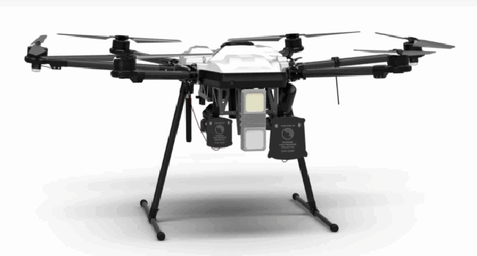
Image Credit: Dronelife
Fortem Technologies Expands Manufacturing to Meet Global Demand for Counter-Drone Systems
- Fortem Technologies has expanded its manufacturing capacity by opening a new 51,000-square-foot facility in Lindon, Utah to meet the global demand for its counter-drone systems.
- The new facility more than doubles Fortem's previous capacity and allows key manufacturing processes to be brought in-house.
- Fortem's counter-drone systems, like DroneHunter®, DroneKiller™, and TrueView™ radar, are increasingly deployed in military and security operations globally.
- The facility includes 10,000 square feet of dedicated manufacturing space and on-site flight testing areas.
- At full capacity, the facility can produce 600 radar units, 40 DroneHunter® interceptors, over 300 ground-launched air-to-air munitions, and 20 drone hangars per month.
- Fortem has completed over 70,000 test flights and 5,500 drone captures in Utah.
- The company's radar-guided interceptors, powered by AI, are designed to detect and neutralize fast, low-flying drones evading traditional radar.
- Fortem is the only company authorized to deploy drone-on-drone kinetic interceptors in U.S. airspace.
- With ISO 9001:2015 and AS9100D certifications, Fortem is reducing reliance on foreign suppliers and growing its team in Utah.
- Fortem Technologies offers TrueView™ radar, SkyDome® software, and non-lethal and lethal drone interceptors to protect critical infrastructure.
- The company is backed by investors like Boeing, Lockheed Martin, and Toshiba.
- Fortem's technology has been validated in global defense operations and aims to safeguard both current critical infrastructure and advanced air mobility systems.
- The company's products are trusted by military, government, and commercial clients worldwide.
- Fortem's team has expanded to over 100 employees in Utah, with the potential to double in size to meet increasing demand.
- Miriam McNabb is the Editor-in-Chief of DRONELIFE, observing the drone industry and regulatory environment.
- Fortem Technologies' new facility signifies a significant step in building and deploying advanced air-defense systems effectively.
Read Full Article
13 Likes
Dronelife
136

Image Credit: Dronelife
Terra Drone and MODEC Renew Partnership to Advance Offshore Oil Tank Inspections
- Japan’s Terra Drone and MODEC have renewed their partnership to enhance offshore oil tank inspections utilizing Terra's UT drones for FPSOs.
- The collaboration focuses on non-destructive internal inspections of crude oil storage tanks on FPSOs, improving accuracy, safety, and efficiency.
- Terradrone's UT drones offer industrial-grade capabilities, assess steel wall thickness, and detect corrosion using ultrasonic sensors.
- Before measurements, tanks are cleaned, a gel is applied for ultrasonic transmission, and sensors assess tank walls for internal conditions.
- The partnership aims to optimize the operational deployment of this technology for enhanced inspection practices in the oil and gas industry.
- MODEC and Terra Drone innovate drone inspection techniques to enhance occupational safety, reduce manpower, and improve efficiency on FPSOs.
- By utilizing drones, FPSOs can save time during structural inspections, addressing challenges related to crew limitations and facility needs.
- The tethered power supply of Terra UT drones ensures uninterrupted flight, eliminating the requirement for battery changes.
- Through the renewed partnership, both companies seek to promote the adoption of drone-based inspection technologies across the industry.
- The companies are committed to improving workplace safety, tackling labor shortages, and streamlining inspection operations using drone technology.
Read Full Article
8 Likes
Dronelife
317
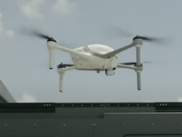
Image Credit: Dronelife
Drones on Demand: How Automated Systems Are Transforming Emergency Response
- Drones-in-a-box systems are transforming emergency response for public safety agencies and private companies, as seen in Texas with the deployment of drones for accident data collection and equipment malfunction assessments.
- Strategically placed docking stations in West Texas enable quick dispatch of drones to remote energy facilities, replacing inefficient manual drone workflow and reducing pilot fatigue from excessive travel.
- Companies like DroneDeploy and Ondas Holdings offer advanced drone-in-a-box solutions, enhancing operational efficiency by automating battery changes and payload replacements, allowing drones to remain on mission almost continuously.
- Considerations for choosing a drone-in-a-box system include individual needs assessment and affordability, as emphasized by UAS program manager Jason Day from the Texas DPS.
- These systems are valuable for emergency management, aiding in natural disaster response by collecting pre-disaster data and assessing infrastructure vulnerabilities before events like hurricanes or floods.
- Drones in boxes can provide continuous UAV coverage for coastlines during disasters, with plans for a network of drone docks along the Texas Gulf Coast to benefit public safety, oil and gas, insurance, and electricity providers.
- Robust drone-in-a-box systems like those from Ondas Holdings have proven effectiveness in extreme weather conditions and pre-disaster data collection, showcasing their utility in emergency management scenarios.
- The integration of drones in emergency response is part of a larger trend towards leveraging technology like AI, robots, and drones for societal benefit, as reflected in the work of writer Jim Magill.
Read Full Article
19 Likes
The Drone Girl
387

Trump’s stance on drones: how we should think about a drone reboot in 2025
- On June 6, 2025, President Trump signed two Executive Orders focusing on drones, aiming to boost innovation and security in U.S. drone operations.
- One order enables Beyond Visual Line of Sight (BVLOS) operations for commercial use, while the other focuses on drone security and U.S.-manufactured drones.
- The Executive Orders aim to modernize American drone operations across commercial, public safety, and defense sectors, addressing regulatory challenges and security risks.
- Industry experts see the potential for rapid growth in the drone industry with the removal of regulatory barriers and increased investment opportunities.
- The Orders accelerate BVLOS rulemaking, streamline UAS waiver approvals, and prioritize U.S.-manufactured drones for federal use.
- They also establish drone restrictions, enable counter-drone tools, and promote airspace security measures.
- The Orders signal a shift towards minimizing reliance on Chinese-made drones, posing implications for companies like DJI in the market.
- Immediate changes following the Orders may include expanded drone operations for delivery, inspections, and emergency services, enhancing safety and efficiency.
- The drone industry anticipates cost reduction, improved safety, and regulatory clarity, paving the way for significant growth and innovation.
- With these directives, drones are viewed not just as gadgets but as critical infrastructure shaping the future of various sectors.
Read Full Article
23 Likes
Dronevideos
17

Image Credit: Dronevideos
Drones Light Up Japan’s Sky in National Drone Show Competition
- Kōmei Sasaki, a drone enthusiast, founded RedCliff to become Japan's premier drone light show provider.
- In 2021, RedCliff produced Japan's largest drone show, gaining national attention.
- Kōmei established the Japan Drone Show Association (JDSA) to support drone show industry growth and innovation.
- JDSA aims to address challenges like rule-making and technical issues while promoting drone light shows in Japan.
- The association includes members from various sectors to ensure safe integration of drone shows into cultural life.
- JDSA launched the Japan Drone Show Creativity Awards in 2025 to recognize outstanding drone light shows in Japan.
- RedCliff won four out of five award categories, showcasing its drone expertise and creativity.
- Various drone shows, including those by RedCliff and Nordrohn Drone Show, were highlighted for their innovation and regional impact.
- Kōmei and JDSA are pivotal in shaping Japan's drone light show industry, focusing on safety standards and creativity.
Read Full Article
1 Like
For uninterrupted reading, download the app